

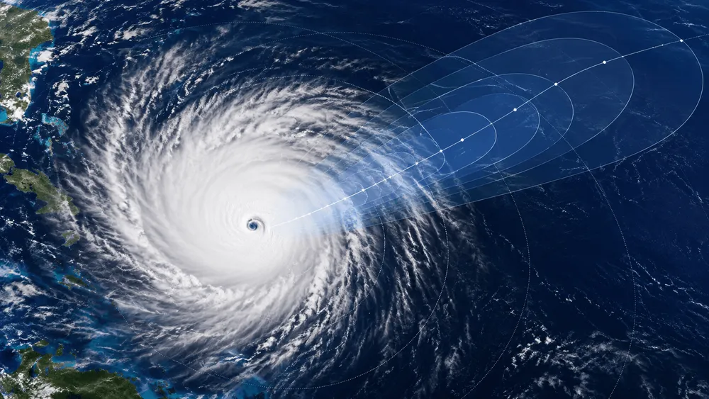
On August 6, 2026, Google DeepMind open-sourced "WeatherNext Cyclones" (WN-C), a model that forecasts the track, intensity, and wind field of tropical cyclones globally up to 15 days ahead. A paper published in Nature on the same date reports that, in an evaluation of tropical cyclones from 2023–2025, the model achieved an average lead advantage of more than one day over leading operational models. Beyond track, it handles intensity and wind extent simultaneously with probabilities, and it also expands the scale of the ensemble, which had traditionally been constrained by computational cost. Even so, this average figure cannot be substituted for certainty about any individual storm or warning. What determines practical usefulness is how well a global model captures intensity changes and how forecast spread can actually be used on the ground.
WeatherNext shows an average lead advantage of over one day in a 2023–2025 case evaluation
WN-C simultaneously outputs, as probabilistic forecasts, the track indicating the center position of a tropical cyclone, the intensity corresponding to maximum wind speed, and the wind field including wind radii. The forecast period extends up to 15 days. According to the abstract of the Nature paper, in a case evaluation covering 2023–2025, these forecasts achieved an average lead advantage of more than one day over leading operational models. The paper also states that adding WN-C to a weighted consensus ensemble substantially improved skill.
What should be read carefully in this comparison is that being able to "issue forecasts out to 15 days" is different from "issuing warnings with the same accuracy throughout those 15 days." What the paper shows is average performance under a defined evaluation procedure, not a guarantee of a one-day lead for any specific ocean basin, developmental stage, or landfall time. With probabilistic forecasts, rather than fixing on a single track, understanding how likelihood is distributed across a range also serves as a basis for judgment.
The yardstick for evaluation itself also has its scope. In verifications by the U.S. National Hurricane Center (NHC), official forecasts issued every six hours are compared against center position and maximum 1-minute sustained surface wind. This serves as a premise for not lumping track and intensity together into a single, undifferentiated "forecast accuracy." The results in the WN-C paper, too, need to be understood as performance tied to the specific targets, forecast times, and evaluation metrics that were set.
Track and intensity fundamentally involve different challenges. Track is heavily influenced by broad-scale atmospheric flow, whereas intensity is governed by thermodynamic processes in the compact inner core. For this reason, operational physical models have had to allocate computational resources among covering the globe broadly, resolving the inner core at high resolution, and running many forecasts in parallel to gauge uncertainty. The WN-C evaluation, too, is designed to compare against the global ENS for track and the high-resolution HAFS for intensity.
Google DeepMind explains that WN-C supported the U.S. National Hurricane Center during the 2025 hurricane season and forecast the rapid intensification and Jamaica landfall of Hurricane Melissa. According to an NHC report, Melissa's maximum sustained wind speed increased by 45 knots in 24 hours. Rapid intensification is a phase that is notoriously difficult to forecast, and this case illustrates the conditions under which the model was tested. That said, this is an account of the company's operational contribution, and it does not mean that WN-C alone issued the official warning.
Forecasting intensity from coarse global data
WN-C is trained by combining global atmospheric fields with prediction targets specific to tropical cyclones. Training used approximately 20 TB of global atmospheric data and the IBTrACS database, which contains records of roughly 5,000 past storms. The supplementary materials list ERA5-derived atmospheric data, HRES-fc0 fine-tuning data, and IBTrACS v4r01 as the primary data sources. The USA_* wind speed fields use 1-minute averages to ensure global consistency.
In forecasting, the global atmospheric state is advanced every six hours, and cyclone attributes are predicted in the course of that process. The main model's input grid is 0.25 degrees, roughly 28 km, which Google DeepMind describes as approximately 100 times coarser than specialized regional models. While this is advantageous for handling a large area within a single model, it does not mean that the cyclone's inner core is physically resolved in the same way as by high-resolution regional numerical weather prediction models.
According to the supplementary materials, WN-C's cyclone attributes are outputs learned from coarse global states and cyclone observations. The announcement materials also state that why accurate intensity forecasting is possible at this resolution remains an open research question. Therefore, while improvements in intensity forecasting are being evaluated as results, this is not grounds for calling it a simulator that fully reproduces inner-core physics.
FGN turns 1,000 scenarios into reality
What changed the scale of computation is Functional Generative Networks (FGN). Unlike GenCast's approach of repeated sampling through a diffusion process, WN-C generates a forecast frame in a single forward pass by feeding a 32-element noise vector into a conditioning layer. This design produces diverse ensemble members from different noise vectors, and Google DeepMind describes it as a mechanism that enables fast, large-scale ensembles.
A 15-day forecast at 0.25-degree resolution takes about one minute on a TPU v5p. According to estimates in the supplementary materials, generating 1,000 members in parallel and writing them out to disk takes about 20 minutes using 256 TPU v5p units. Google DeepMind states that the scale of real-time ensembles has grown from 50 members in the previous release to up to 1,000 members.
The value of expanding the ensemble lies in being able to handle the probability, within the forecast group, of low-frequency but high-impact tracks and wind fields. However, the FGN technical paper only states that it is trained to minimize marginal CRPS at each grid point while being able to capture spatial joint structure. It does not guarantee a physically complete representation of uncertainty.
The public code is an entry point for research
Google DeepMind has released the code and weights for WeatherNext Cyclones and WeatherNext 2 in an official repository. The repository includes the 0.25-degree WN-C checkpoint used operationally in 2025, as well as a smaller, 1-degree "WeatherNext Cyclones Mini." Mini is a variant designed for lower memory and computational requirements, but the same repository explicitly states that it should not be expected to match the performance of the larger model.
The released code is for research purposes and is not an officially supported Google product. The non-Mini model requires an H100 with sufficient GPU memory, and even Mini is not a means to reproduce the large model's results locally as-is. Once you factor in the computational scale needed for 1,000-member ensembles premised on TPUs, release and easy local operation become separate matters altogether.
The 1-degree Mini corresponds to a grid of roughly 111 km, even coarser than the 0.25-degree main model. For researchers and developers, it broadens the entry point for hands-on access to the weights and implementation. At the same time, the caveat that the main model's evaluation figures cannot simply be applied to Mini indicates the need to keep reproduction experiments and large-scale operational evaluation separate.
The official repository and announcement explicitly state that WeatherNext outputs are not a replacement for official forecasts and warnings issued by national meteorological agencies. What should be verified upon adoption is not the published average figures themselves, but whether the gains hold up under each agency's initial conditions and evaluation procedures, and how the spread of the distribution changes warning decisions and the cost of false alarms.